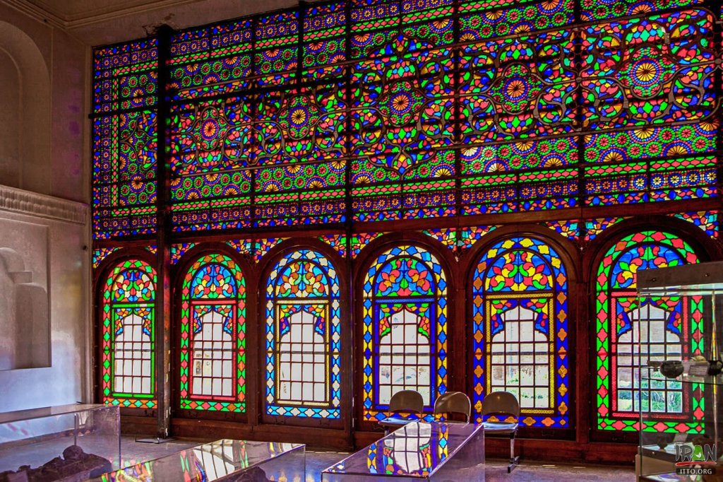
Bandar Abbas
Bandar Abbas
Bandar Abbas is a port city and capital of Hormozgān Province on the Persian Gulf. The city occupies a strategic position on the narrow Strait of Hormuz, and it is the location of the main base of the Iranian Navy.
Its current name derives from that of Shah Abbas I (r. 1588–1629) paired with bandar – “port”.
The city was conquered by the Portuguese in 1514, and was an important location to protect their commerce in the Persian Gulf and India. They named the city Comorão, due to the presence of lobsters and crabs on its shores.
An earthquake in July 1902 damaged parts of the city, including the governor’s house and the customs office, and nearby Qeshm Island.
Mohammad Reza Shah Pahlavi paid particular attention to Bandar Abbas as a strategic port and during his time the government invested huge amounts of capital in the infrastructure.
Bandar Abbas serves as a major shipping point, mostly for imports, and has a long history of trade with India, particularly the port of Surat. Thousands of tourists visit the city and nearby islands including Qeshm and Hormuz every year.
It was a small fishing port of about 17,000 people in 1955, prior to initial plans to develop it as a major harbor. By 2001, it had grown into a major city. It has a population of 450,000 (2011 estimate).
1 day visits:

Hormuz Island
Hormuz Island is an Iranian island in the Persian Gulf. Located in the Strait of Hormuz, 8 kilometres off the Iranian coast, the island is part of Hormozgan Province. Reddish ochre on the island and its beaches, called Golak by natives, has been exploited for artistic and culinary purposes and also attracts tourists. Degradation due to overuse of the ochre has resulted in actions by the Department of Environment to protect it.
Hormuz Island has an area of 42 km2 It is covered by sedimentary rock and layers of volcanic material on its surface. The highest point of the island is about 186 metres above sea level. Due to a lack of precipitation, the soil and water are salty. Specialists have helped cultivar white mangrove or Hara trees to grow in the climate. Due to the lack of fresh water, Iranian engineers have constructed a water pipeline from the mainland. There are many virgin beaches that go all around the island.
The island is arid, and during the summer months the temperature can rise to over 43 °C . all provisions including water had to be brought from the mainland. Its location, however, gave the island a degree of security which let it grow to be a major trading port for several centuries.
Hormuz was visited by Marco Polo, around 1290, while traveling by land, as described in his travelogue.
1 more day to visit Hormuz Island:
The Fort of Our Lady of the Conception, also known as the Portuguese Castle, is a red stone fortress on Hormuz Island. It is one of the last surviving monuments of Portuguese colonial rule in the Persian Gulf
The building of the castle was ordered by Portuguese commander Afonso de Albuquerque in 1507, when his forces seized the island for a short time, being then named “Fort of Our Lady of Victory” . Engaging his men of all ranks in the building works, Albuquerque faced a revolt and had to retreat. He came back and reconquered the island in 1515, when he completed and renamed the fort.
Qeshm Island
Qeshm Island is located in the Persian Gulf a few kilometers from the port city of Bandar Abbas in the Strait of Hormuz. it is a free zone of 300 km2, 135 km long and its thickness varies from 9.4 to 40 km. it is 60 km from the Omani port of Khasab and about 180 km from the Rashid port of the Arab Emirates United. The island has an area of 1,491 km2 and is 2.5 times the size of Bahrain. The nearest distance to Bandar-Abbass is 2 km.
The average temperature on the island is around 27 ° C. The hottest months are from June to August and the coldest from October to January. The average precipitation is 183.2 mm.
The island comprises 59 towns and villages and the population was 117,774 at the 2011 census. The local population is involved in fishing, dhow building, commerce and services. 30,000 others are administrative or industrial workers or students.
1 more day to visit Qeshm Island:
Gorgan
Gorgan
Gorgan formerly Astarabad is the capital city of Golestan Province, Iran. It lies approximately 400 kmto the north east of Tehran, some 30 km away from the Caspian Sea.
There are several archaeological sites near Gorgan, including Tureng Tepe and Shah Tepe, in which there are remains dating from the Neolithic and Chalcolithic eras. Some other important Neolithic sites in the area are Yarim Tepe, and Sange Chaxmaq. The number of confirmed Neolithic sites on the Gorgan Plain now totals more than fifty.
The Great Wall of Gorgan, the second biggest defensive wall in the world, was built in the Parthian and Sassanian periods.
At the time of the Sassanids, “Gurgan” appeared as the name of a city, province capital, and province.
Gorgan maintained its independence as a Zoroastrian state even after Persia was conquered by the Muslim Arabs in the 8th century.
You need at least 1 day to visit:
The Great Wall of Gorgan is a Sasanian-era defense system located near modern Gorgan in the
It is 195 km long and 6–10 m wide, and features over 30 fortresses spaced at intervals of between 10 and 50 km. It is surpassed only by the walls systems of Great Wall of China as the longest single-segment building and the longest defensive wall in existence.
The wall is located at a geographic narrowing between the Caspian Sea and the mountains of northeastern Iran. It is one of several Caspian Gates at the eastern part of a region known in antiquity as Hyrcania, on the nomadic route from the northern steppes to the Iranian heartland. The wall is believed to have protected the Sassanian Empire to the south from the peoples to the north, probably the White Huns. However, in his book Empires and Walls, Chaichian (2014) questions the validity of this interpretation using historical evidence of potential political-military threats in the region as well as the economic geography of Gorgan Wall’s environs. It is described as “amongst the most ambitious and sophisticated frontier walls” ever built in the world, and the most important of the Sassanian defense fortifications.
Khalid Nabi Cemetery is a cemetery in northeastern Iran’s Golestan province near the border with Turkmenistan, roughly 60 kilometers northeast of Gonbad-e Kavous city. It is mainly situated on a mountain ridge about 1 km distance from the mausoleum called “Khaled Nabi” who according to oral tradition was a pre-Islamic prophet.
The cemetery was visited in 1979 and 1980 by the archeologist David Stronach. He found over 600 standing stones which are spread out in several locations.
Stronach noted two types of gravestones on the site. In both he saw “highly stylized representations of people.”
Type 1 being of a cylindrical column type with a cap-like top with heights between 60 cm to 4 m. Many of them have horizontal ribs on the shaft. Stronach interprets type 1 stones as depictions of men with their caps, helmets and in some case with clearly visible turbans, pointing to parallels in Turkic Ottoman grave-markers.
Type 2 stones are generally smaller, have rectangular sections and two opposed high-set lobes. Stronach interprets these as human shapes with arms in akimbo position.
Gonbad-e Qabus is a monument in Gonbad-e Qabus, Iran, and a UNESCO World Heritage Site since 2012. It marks the grave of Ziyarid ruler Qabus (r. 978–1012), and was built during his lifetime in 1006/7. It is a cylindrical tomb tower that reaches c. 61 metres (200 feet) and can be seen from some 30 kilometres away. The eponymous city is named after the monument.
Considered to be a masterpiece of Iranian architecture. it achieves an “almost perfect balance between a purpose (princely glory beyond death), a form (cylindrical tower transformed into a star), and a single material (brick). The Gonbad-e Qabus tower is the best known tower tomb in northern Iran .
The monument has an interior diameter of 9.67 metres at its base. the building’s entrance contains some of the earliest evidence of the development of the moqarnas structure.
Taking its conical roof into account, the tower measures c. 50 metres above ground.
Sari
Sari
Sari is chief town of Mazandaran Province which is located along the southern coast of the Caspian Sea and in the adjacent Central Alborz mountain range, in central-northern Iran.
Mazandaran Province is one of the most densely populated provinces in Iran and has diverse natural resources, notably large reservoirs of oil and natural gas. The province’s four largest counties are Sari, Amol, Nur, and Tonekabon. It was founded in 1937.
The diverse nature of the province features plains, prairies, forests and rainforest stretching from the sandy beaches of the Caspian Sea to the rugged and snowcapped Alborz sierra, including Mount Damavand, one of the highest peaks and volcanoes in Asia.
Mazandaran is a major producer of farmed fish, and aquaculture provides an important economic addition to traditional dominance of agriculture. Another important contributor to the economy is the tourism industry, as people from all of Iran enjoy visiting the area. Mazandaran is also a fast-growing center for biotechnology.
You need at least 1 day to visit:
Badab Soort is a natural site in Mazandaran Province, 95 kilometres south of the city of Sari, and 7 kilometres west of Orost village. It comprises a range of stepped travertine terrace formations that have been created over thousands of years as flowing water from two mineral hot springs cooled and deposited carbonate minerals on the mountainside.
Badab is a Persian compound of Bād “gas” + āb “water”, translating to “gassed water”, referring to the springs’ waters being carbonated mineral waters.
Badab Soort’s springs are two distinct mineral springs with different natural characteristics, located at 1,840 metres above sea level. The first spring contains very salty water that gathers in a small natural pool; its water is considered to have medicinal properties, especially as a cure for rheumatism and some types of skin diseases and skin conditions. The second spring has a sour taste and is predominately orange mainly due to the large iron oxide sediments at its outlet.
The Ramsar Palace or Marmar Palace is one of the historic buildings and royal residences in Iran. The palace is in Ramsar, a city on the coast of the Caspian Sea.
The Ramsar Palace was established on a land of 60,000 square meters in 1937. The area was a historical garden in Ramsar. The palace was used as a summer residence by Reza Shah and then by his son, Mohammad Reza Pahlavi. Mohammad Reza Pahlavi and his second spouse Sorayya Esfendiari spent their honeymoon in the palace.
Rasht
Rasht
Rasht
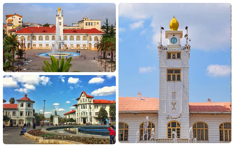
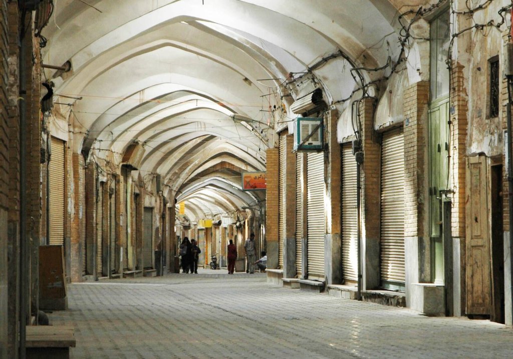
Rasht is the capital of the province of Gilan. Also known as the “city of rain”, it had 639,951 inhabitants according to the census of October 24, 2011 and is the most populous city in Iran.
Rasht is the largest city on the Iranian coast of the Caspian Sea. It is a major commercial center between the Caucasus, Russia and Iran through the port of Bandar-e Anzali. Rasht is also a major tourist center, we can name the village of Masouleh in the adjacent mountains and the beaches of the Caspian.
Historically, Rasht was an important transportation and trade hub that connected Iran with Russia and the rest of Europe, and because of this, it was known as the “Gateway to Europe”. history dates back to the 13th century Rather to the Safavid era when Rasht was an important center of silk trade with many textile workshops.
The name Rasht most likely comes from the verb reshtan, weaving. Rasht had one of the first industrial factories already in the last quarter of the 19th century like towns like Tabriz and Tehran and renowned in areas such as fishing, caviar production, construction of Caspian pipelines and textiles. During the 20th century, until the mid-1970s, Rasht and were the third largest industrial city in Iran in terms of number of workers and productivity per capital. It largely lost its cultural and industrial status after the 1970s.
You need at least 1 day to visit:
The municipal palace of Rasht or pavilion was built between 1276 and 1305 by order of the municipality of Rasht. The architecture of this building is inspired by the architecture of Saint Petersburg. Before the construction of this building, the land had the shape of a hill on which stood the tomb of Agha Seyyed Abu Ja’far. One of the beautiful attractions of this city that catches the attention of tourists is the white building of the Municipality Palace.

The beautiful square of Rasht is located in the center of the city of Rasht and counts among the oldest places in the city, built in the period of the first Pahlavi. the buildings located in the square including the municipal buildings, the post office, the national library, the cobbled street as well as the statue of Mirza Kuchak Khan are over one hundred years old. This statue is classified as a national monument. Although the Rasht municipal complex was damaged in the Manjil earthquake in 1990, it has been restored and returned to its original condition. On some occasions a musical orchestra plays there and many people come to listen to it.
Bandar-e Anzali known as Bandar-e Pahlavi before the Iranian Revolution is a city of Gilan Province, Iran. At the 2011 census, its population was 144,664.
Anzali is one of the most important cities in Iran in terms of tourism, economics, and athletics. The city was home to the first and biggest port on the southern shores of the Caspian Sea. Bandar-e Anzali consists of an island called Mianposhteh and the surrounding lands. Tourist attractions include a clock tower called Manareh, the long harbour promenade, and the water-logged delta and beach along the Sefid Rud
Ardebil
Ardebil
Ardebil
Ardebil is an ancient city in northwestern Iran, and the capital of Ardabil Province. The dominant majority in the city are ethnic Iranian Azerbaijanis and the primary language of the people is Azerbaijani.
Ardabil is known for its trade in silk and carpets. Ardabil rugs are renowned and the ancient Ardabil Carpets are considered among the best of classical Persian carpets. Ardabil is also home to a World Heritage Site, the Ardabil Shrine, the sanctuary and tomb of Shaikh Safî ad-Dîn, eponymous founder of the Safavid dynasty.
The population of Ardabil is about 650,000 and their religion is Shia Islam.
You need at least 1 day to visit:
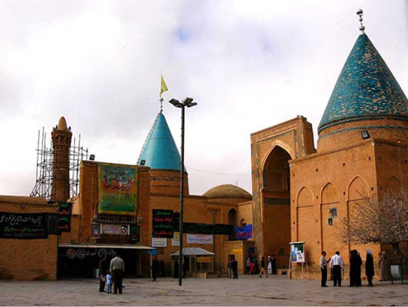
Sheikh Safiodin Complex
Sheikh Safi, an eminent leader of an Islamic Sufi order established by the Safavids, was born in Ardabil where this complex is located. The Safavids valued the tomb-mosque form, and the tomb with its mausoleum and prayer hall is located at a right angle to the mosque. The buildings in the complex surround a small inner courtyard (31 by 16 meters). The complex is entered through a long garden.
The Mausoleum of Sheikh Safi, in Ardabil, was first built in1334. It was constructed between the beginning of the 16th century and the end of the 18th century. The mausoleum, a tall, domed circular tower decorated with blue tile and about 17 meters in height; beside it is the 17th-century Porcelain House preserving the sanctuary’s ceremonial wares. Also part of the complex are many sections that have served a variety of functions over the past centuries, including a library, a mosque, a school, mausolea, a cistern, a hospital, kitchens, a bakery, and some offices. It incorporates a route to reach the shrine of the sheikh divided into seven segments, which mirror the seven stages of Sufi mysticism. Various parts of the mausoleum are separated by eight gates, which represent the eight attitudes of Sufism.
Several parts were gradually added to the main structure during the Safavid dynasty. A number of Safavid sheikhs and harems and victims of the Safavids’ battles, including the Battle of Chaldiran, have been buried at the site.
Jameh Mosque Ardabil exists only in ruins.
The current buildings are remnants of the Seljuk era, which ruled Iran in the second half of the 11th and 12th centuries. Perhaps there were other older buildings. During excavations, it was found that the mosque complex was once larger, but was destroyed over time. The ruined brick walls are protected by a temporary protective roof consisting of steel beams and a corrugated iron roof. The resulting cylindrical stump of the minaret is stabilized from the outside by a surrounding steel frame.
The mosque is located in the district of Pir Shamso-d-Din in the middle of a cemetery and consists of three parts:
The minaret, in Seljuk style from 1473 (or 1474) consists of two octagonal parts, each 2.10 m long, and a cylindrical tower, 5 m in diameter with two inscriptions mentioning Uzun Hasan (1423, ruled 1453 –1478) chief of the Aq Qoyunlu tribe, as the one who ordered the construction.
The second part of the complex is the Tirpusch, a beamed prayer room, 12.5 m long and 9.8 m wide. The roof is supported by 9 wooden pillars.
The third part of the complex consists of 4 rooms with a dome. It was built in brick and partially decorated with tiles.
Sareyn
Sareyn is a city, in Ardabil Province. Sareyn is known for its hot springs. The population is about 8000, and increases to more than 20000 in the summer because of the many tourists who go there due to the charming climate. It stands 25 km from Ardabil and total area is 1.28 square km2.
The Sareyn springs are near an inactive volcano in mount Sabalan and its water contains sulphur particles and it is believed that it is good for bone and joint pains.
The climate and hot springs are the first attractions to tourists who travel to this region from different parts of Iran and the world.
Sareyn is also famous for its ‘Ashe Doogh’ (Yogurt Soups), during the busy summer periods, it is not uncommon for many of the local shops to be seen selling and preparing this soup.
Hot springs (spa) have always been in Sarein but the 1990 Manjil–Rudbar earthquake caused some of them to get colder or hotter. The water is heated largely by the Sabalan mountain which is Iran’s second highest mountain after Damavand.
Many tourists visit Sabalan. Its most interesting feat is the ‘crater’ top which contains a lake of acidic water.
Sareyn is also very famous for its honey, again like the soup, many of Sareyn’s shops sell honey which is produced locally by the Bee keepers of the area.
There are 9 hot springs in Sarein, with ‘Gavmesh Goli’ being the hottest, with water reaching 67 degrees, and turning out around 80 liters per second from the source. There is also several cold water springs nearby, with the most popular being situated in a small village nearby called ‘Vila Dareh’ – the water here is fizzy and is very good for the kidneys.
Urmia
Urmia
Urmia or Orumiyeh is the capital of Urmia County. It is situated at an altitude of 1,330 metres above sea level, and is located along the Shahar River on the Urmia Plain. Lake Urmia, one of the world’s largest salt lakes, lies to the east of the city, and the mountainous Turkish border area lies to the west.
Urmia is the 10th most populated city in Iran. At the 2012 census, its population was 667,499, The city’s inhabitants are predominantly Azerbaijanis who speak the Azerbaijani language. There are also minorities of Kurds, Persians, Assyrians, and Armenians. The city is the trading center for a fertile agricultural region where fruits (especially apples and grapes) and tobacco are grown. Even though the majority of the residents of Urmia are Muslims, the Christian history of Urmia is well preserved and is especially evident in the city’s many churches and cathedrals.
You need at least 1 day to visit:
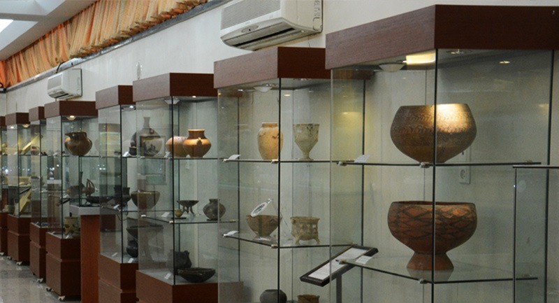
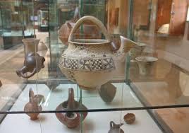
Urmia Museum with 30,000 historical objects, is considered one of the richest and largest Iranian museums. This museum consists of two main parts, archeology, and anthropology. Valuable artifacts discovered from ancient hills, belonging to the time from the Neolithic period to the end of the Qajar era are exhibited. The tradition and culture of people from the late Safavid era up to now are exhibited in the anthropology hall. In the prehistoric and historic section, Urmia Museum holds various stone, pottery, and metal works from the Neolithic to the early Islamic era. Stone made tools and instruments belonging to the 6th and 7th millennium BC, fine beautiful pottery from the 5th millennium BC, decorative metal works and bronze lion sculpture along with cuneiform scripts, silver coins, glass containers of the Sassanid period, and jewelry are some but not all the objects that are collected in Urmia Museum. In the decorative arts section, interesting objects such as verses from the Holy Quran written in Naskh and Nastaliq script which are two types of Iranian calligraphic handwriting, and miniatures from the 19th and 20th centuries are provided. There are coins from the pre-Islamic era, as well as coins from the Islamic period. This museum was established in 1967 and receives many tourists every year.
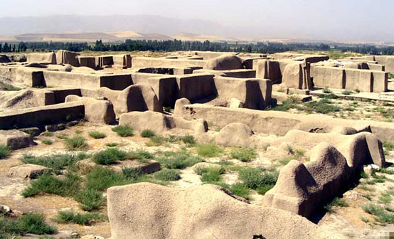
Teppe Hasanlu is an archeological site of an ancient city, located in northwest Iran), a short distance south of Lake Urmia. The nature of its destruction at the end of the 9th century BCE essentially froze one layer of the city in time, providing researchers with extremely well preserved buildings, artifacts, and skeletal remains from the victims and enemy combatants of the attack.
The site consists of a 25-m-high central “citadel” mound, with massive fortifications and paved streets, surrounded by a low outer town, 8 m above the surrounding plain. The entire site, once much larger but reduced in size by local agricultural and building activities, now measures about 600 m across, with the citadel having a diameter of about 200 m.
The site was inhabited fairly continuously from the 6th millennium BCE to the 3rd century CE. It is famous for the Golden bowl of Hasanlu. Since June 2018, the Cultural Heritage, Handicrafts and Tourism Organization has pushed for the entire archeological site to be declared a UNESCO World Heritage Site.
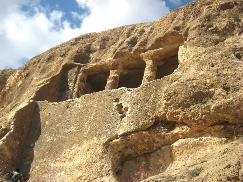
Rock tomb in Fakhrigah is 15 km North-East of Mahabad in West Azerbaijan province, Western Iran. The tomb is carved into the face of a rocky outcrop. It is located along the Mahabad−Miandoab road to the South of the village Inderghash, in Iranian Kurdistan.
In 1936 Aurel Stein, the British archaeologist and Explorer wrote about the tomb and defenses
Grave of the structures includes a porch, behind which is a room containing the grave. The tomb is the only one of all the rock tombs identified in Iran with a facade, and the interior which has columns and lacks any walls. The facade of the tomb was built on a perfectly smooth stone wall with an average height of 4.70 meters and the same width as the façade. The columned porch is surrounded by an engraved frame, the band of which is 22 cm, and which ends on two sides with two stepped platforms of the front porch.
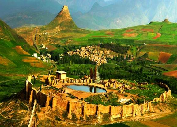
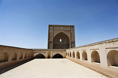
Takht-e Soleymān is an archaeological site in West Azerbaijan, Iran from Sasanian Empire. It lies midway between Urmia and Hamadan.
The fortified site, which is located on a hill created by the outflow of a calcium-rich spring pond, was recognized as a World Heritage Site in July 2003. The citadel includes the remains of Adur Gushnasp, a Zoroastrian fire temple built during the Sassanid period and partially rebuilt (as a mosque) during the Ilkhanid period. This temple housed one of the three “Great Fires” or “Royal Fires” that Sassanid rulers humbled themselves before in order to ascend the throne. The fire at Takht-i Soleiman was called Adur Gushnasp and was dedicated to the arteshtar or warrior class of the Sasanid. A 4th century Armenian manuscript relating to Jesus and Zarathustra, and various historians of the Islamic period, mention this pond. The foundations of the fire temple around the pond is attributed to that legend. Takht-E Soleyman appears on the 4th century Peutinger Map.
This site got its biblical name after the Arab invasion of Iran in the 7th century. Folk legend relates that King Solomon used to imprison monsters inside a nearby 100 m deep crater which is called Zendan-e Soleyman “Prison of Solomon”. Solomon is also said to have created the flowing pond in the fortress.
Archaeological excavations have revealed traces of a 5th-century BC occupation during the Achaemenid period, as well as later Parthian settlements in the citadel. Coins belonging to the reign of Sassanid kings, and that of the Byzantine emperor Theodosius II (AD 408–450), have also been discovered there.
Semnan
Semnan
You need at least 1 day to visit:
Bastam is a city in and capital of the Bastam District of Shahrud County, Semnan Province, Iran.
Bastam was founded in the 6th century in the Greater Khorasan. It is 6 kilometres north of Shahrud. The town is known for its Islamic monuments from the Ilkhanid period and its association with the mystic Bayazid Bastami.
Bāyazīd Bisṭāmī was a Persian Sufi from north-central Iran.Known to future Sufis as Sultān-ul-Ārifīn (“King of the Gnostics”), Bisṭāmī is considered to be one of the expositors of the state of fanā, the notion of dying in mystical union with Allah. Bastami was famous for “the boldness of his expression of the mystic’s complete absorption into the mysticism.”
Shahrood Museum is a two-story building, architectured to the style of the late Qajar and early Pahlavi reigns. The museum comprises two sections, named as archaeology and anthropology. This museum has two sections of archeology and anthropology with more than 800 pieces of historical artifacts and its oldest museum is stone and bone tools dating back 8,000 years ago to the Chakhmaq hill of Shahrood, in Semnan Province.
Khoramabad
Khoramabad
You need at least 1 day to visit:
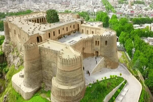
Falak-ol-Aflak castle is amongst the most important structures built during the Sassanid era. It has been known by a number of names since it was built over 1800 years ago. Recorded names have referred to it as Shapur-Khast or Sabr-Khast fortress, Dezbaz, Khoramabad castle, and ultimately the Falak-ol-Aflak Castle.
Under the Pahlavi dynasty, after being used as a prison until 1968, it was transformed into a museum complex.
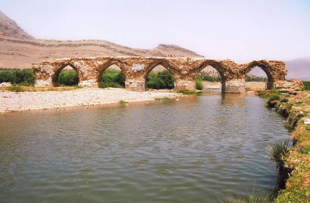
Shapuri Bridge or Broken Bridge is a historical bridge from Sassanid era located in the south of Khorramabad in Lorestan province. The bridge has 28 arches (of which only 6 remain) and 27 Pile bridges, each 61 square meters; five of its arches are intact and the others have been destroyed by natural factors.The arches of the bridge have been constructed of stone, whereas the bridge itself is a mixture of stone and mortar.Shapoori Bridge is registered on the list of National Monuments.
Sanandaj
Sanandaj
sanandaj
You need at least 1 day to visit:
Sanandaj Museum was originally a “Qajar” period house built as the residence of “Molla Lotfollah Sheikholeslam”, one of the spiritual leaders of “Qajar” era. It was transformed into a museum in 1967.
It consists of a basement and a ground floor. Archeological items are exhibited in basement and ethnological materials are on show on the ground floor. Various cultural objects from the region of Kurdistan, as well as other parts of Iran are housed here.
Pigeon tower, a source of fertilizer
Pigeon tower was used as a safe house and shelter for the pigeons but this wasn’t the only function.
They were built around the farms to collect their droppings as fertilizer!
Pigeon tower, a source of fertilizer
Pigeon tower was used as a safe house and shelter for the pigeons but this wasn’t the only function. They were built around the farms to collect their droppings as fertilizer! Every 6 month the farmers collected the dropping and used them in their farms or even they sold it. Today we know that these droppings are rich in Nitrogen, a critical element for cucurbits such as melons. No surprise that melons of Isfahan have had a reputation since 1000 years ago.
The structure includes a central cylinder which is surrounded by several smaller cylinders; all are made of brick and plaster. There are thousands of nests on the internal surface of the cylinders.
The only entrance to the tower was a set of holes on the top, just as big as a pigeon, to prevent the birds of prey from entering the tower. There is also a white stripe around the external surface of the tower which is slippery for snakes.
Pigeon towers are only found in Isfahan province and some of these organic fertilizer factories are reconstructed for the people and tourists to visit.
